|
| |||
|
|
|
Bass River Bridges Lower Bass River Bridge (Route 28) 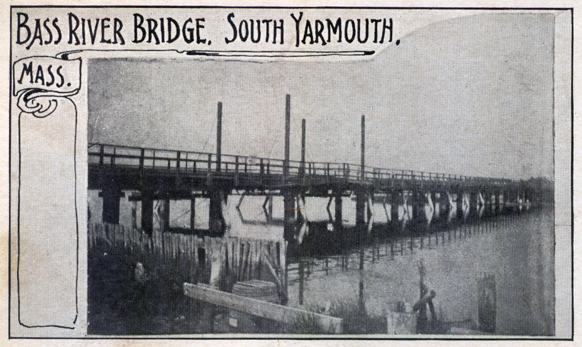 The first bridge, replacing the ferry service between Union Street - South Yarmouth and Ferry Street - West Dennis was built in 1832. The four tall pilings are at the location of a draw-bridge to allow sailing vessels access to the upper River 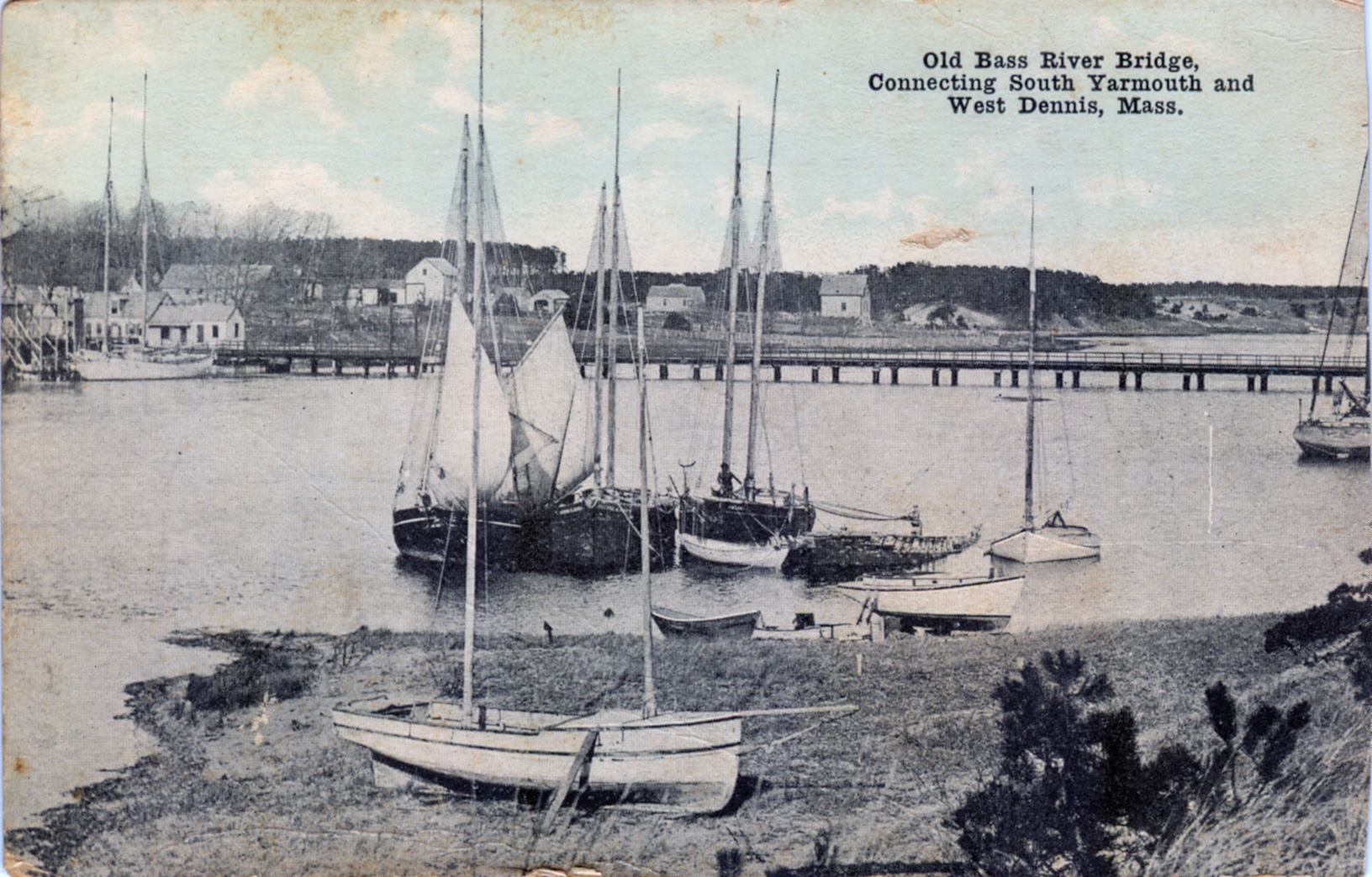 A somewhat later view of the same basic bridge 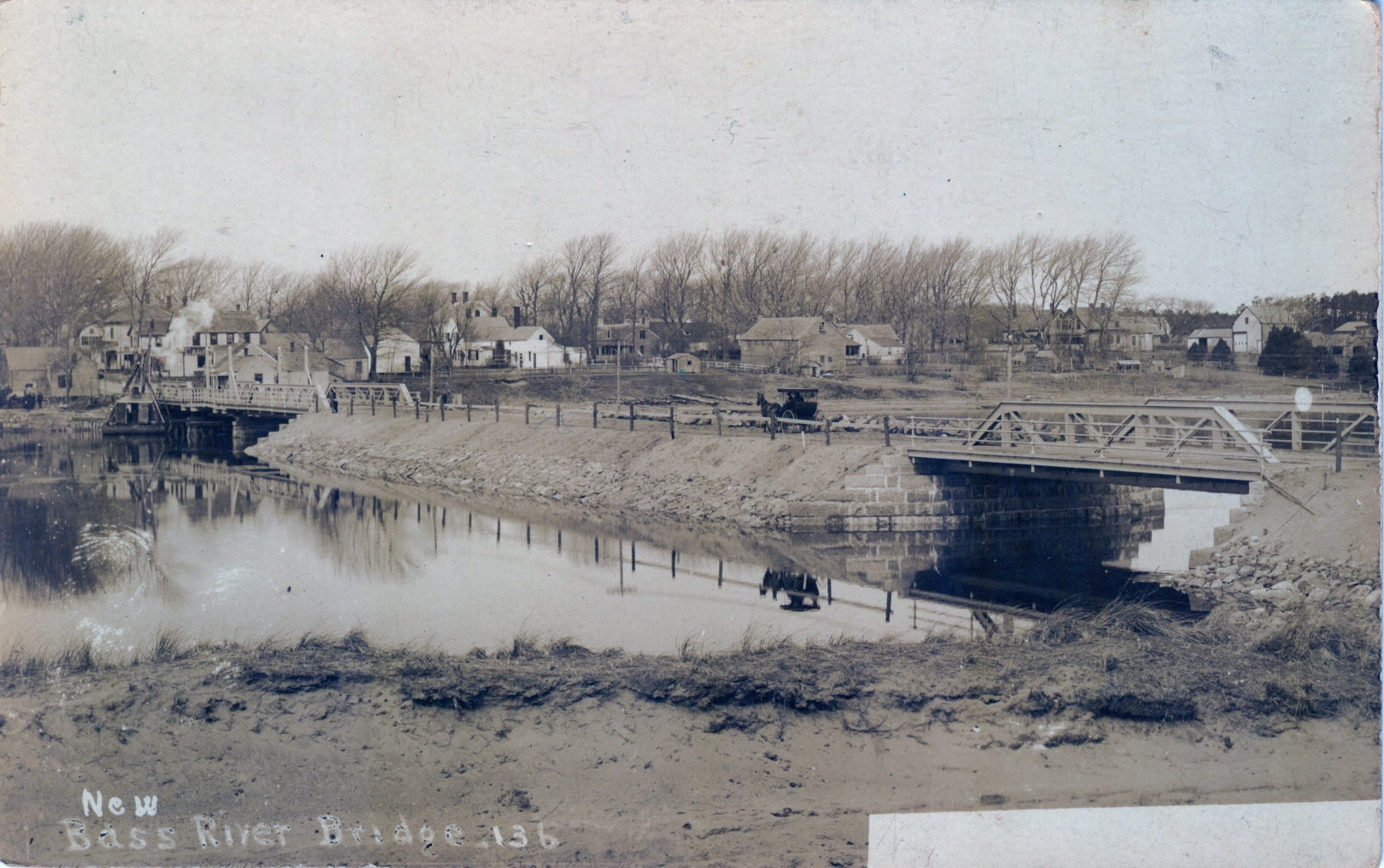 This 1907 view shows the "new" bridge with a draw bridge still on the Yarmouth side, a smaller span on the Dennis side, and an earthen bank in the middle. (And you wondered why it was so shallow there....) 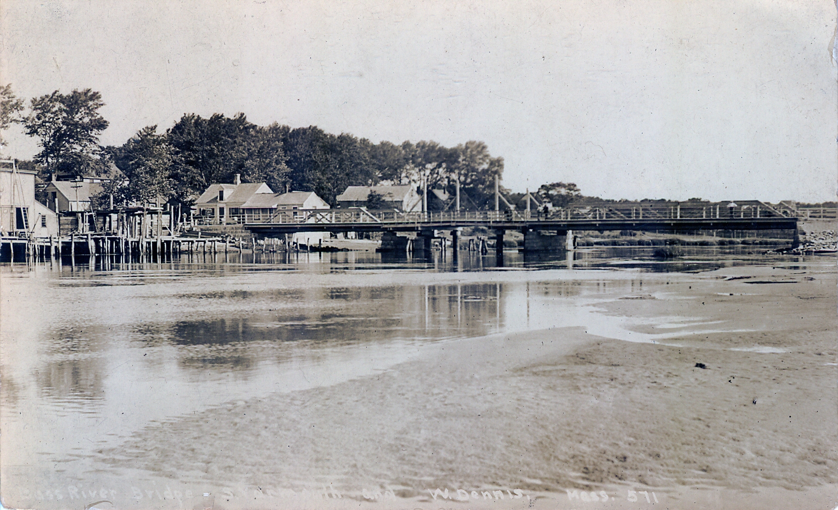 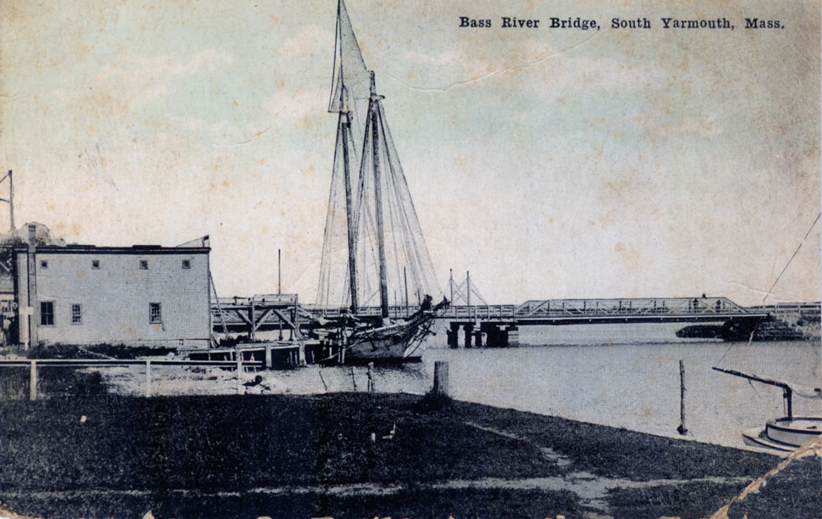 This view also shows one of the sailing packets, probably the David K Akin, at Fullers Wharf, the present day home of Packet Landing. 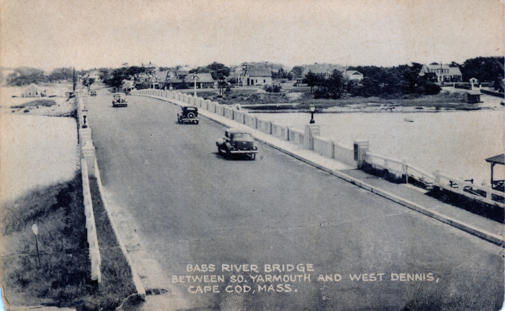
This view shows the third bridge, completed in 1935 as part of the South
Yarmouth "Bypass" from the bridge to Small's gas station. We have to wait to
see what the "fourth" bridge will look like as the State plans to replace
this bridge beginning in 2021.
They may need more than just the pedestrian walkway (below) that was built to provide temporary access during the construction of the 1935 bridge. 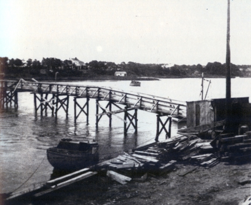 High Bank Bridge (1953)  Railroad Bridge (1865) Lumber train en-route to Mid-Cape Lumber in South Dennis. c.1985. 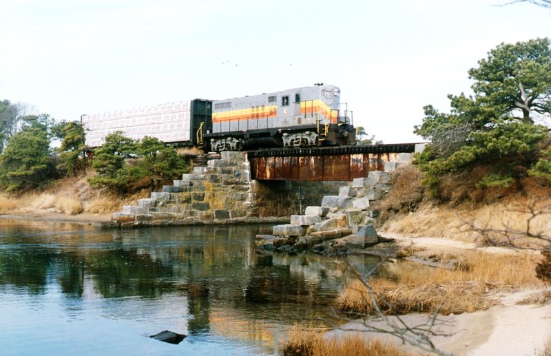 Removal of the bridge span - 2012 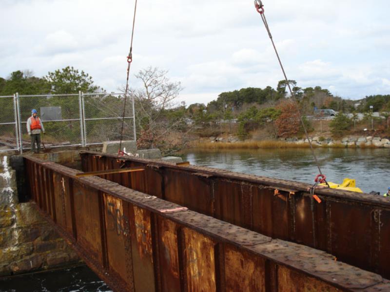 Mid-Cape Highway Bridges (1954)  Cove Bridge Across the entrance to Grand Cove. Destroyed by winter ice in the early 1900s. Even 100 years later, you can see the road approaches to the former bridge site. 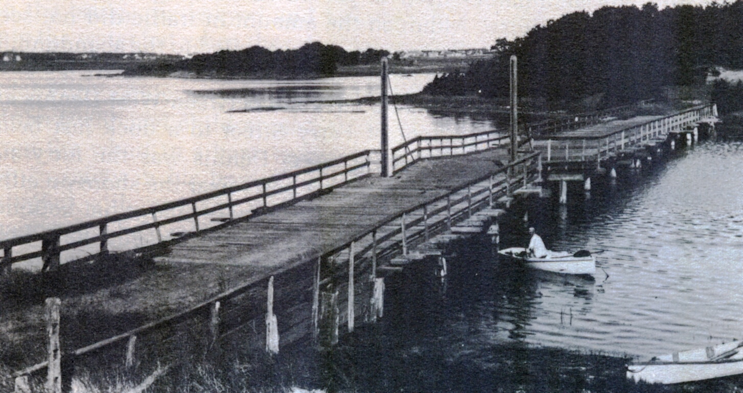
Bass River Local Information
|
|